Marrowstone, Washington
Census-designated places in Jefferson County, WashingtonCensus-designated places in Washington (state)Headlands of Washington (state)Landforms of Jefferson County, WashingtonPopulated places on Puget Sound ... and 1 more
Use mdy dates from June 2013

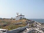
Marrowstone is a census-designated place (CDP) in Jefferson County, Washington, United States. The population was 844 at the 2010 census. All Marrowstone addresses are in Nordland, Washington, and the ZIP code for Marrowstone Island is 98358. Marrowstone takes its name from Marrowstone Point, the northernmost point on Marrowstone Island. It was given the name "Marrow-Stone Point" in 1792 by the British explorer, George Vancouver, in describing the area's hard, clay-like soil.
Excerpt from the Wikipedia article Marrowstone, Washington (License: CC BY-SA 3.0, Authors, Images).Marrowstone, Washington
East Beach Road,
Geographical coordinates (GPS) Address Nearby Places Show on map
Geographical coordinates (GPS)
| Latitude | Longitude |
|---|---|
| N 48.058333333333 ° | E -122.68805555556 ° |
Address
East Beach Road 155
98358
Washington, United States
Open on Google Maps


