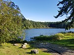
Port Townsend Ship Canal
Canals in Washington (state)Canals opened in 1915Transportation buildings and structures in Jefferson County, WashingtonWashington (state) stubs
The Port Townsend Ship Canal (also known as the Portage Canal) is a 4,800-foot (1,500 m) canal connecting Port Townsend Bay and Oak Bay in Jefferson County, Washington. Built in 1915, the canal separates Indian Island from the Quimper Peninsula of mainland Washington. State Route 116 crosses the only bridge over the canal. There are no locks.
Excerpt from the Wikipedia article Port Townsend Ship Canal (License: CC BY-SA 3.0, Authors).Port Townsend Ship Canal
Flagler Road,
Geographical coordinates (GPS) Address Nearby Places Show on map
Geographical coordinates (GPS)
| Latitude | Longitude |
|---|---|
| N 48.030277777778 ° | E -122.72944444444 ° |
Address
Flagler Road 2850
98339
Washington, United States
Open on Google Maps


