place

Trelogan

Clwyd geography stubsVillages in Flintshire
Trelogan fields geograph.org.uk 182289

Trelogan is a village in Flintshire, north east Wales. It is located between Mostyn and Trelawnyd and is almost contiguous with Berthengam. Trelogan had a population of 671 as of the 2011 census.The village has its own primary school (Ysgol Gynradd Trelogan), community centre, photographers studio, animal rescue centre and, until 2005, its own post office. As of early 2017 North Clwyd Animal Rescue opened their own cafe which is open to the public. The placename Trelogan derives from the name Logan, the person believed to have founded the village having been named that. The village in history was the locality for several lead-zinc mines, working at least until 1841. Many people in Japan are familiar with Trelogan, as UK scientists developed a process to plant the semi-toxic, at least to plants, spoil tips from the lead-zinc mines with native UK plant species. Up to this point it had not been possible to grow plants on this type of semi-toxic terrain which was common in Japan due to the many lead-zinc mines in operation.

Excerpt from the Wikipedia article Trelogan (License: CC BY-SA 3.0, Authors, Images).

Geographical coordinates (GPS)

Latitude Longitude
N 53.31 ° E -3.321 °
placeShow on map

Address


CH8 9BB , Llanasa
Wales, United Kingdom
mapOpen on Google Maps

Trelogan fields geograph.org.uk 182289
Share experience

Nearby Places

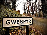
Gwespyr
Gwespyr

Gwespyr is a village in Flintshire on the north coast of Wales in the community of Llanasa. Gwespyr had a population of 289 people in the United Kingdom 2001 census. It overlooks Point of Ayr on the west side of the River Dee estuary and its sandy beaches with dunes. The hills of the Clwydian Range behind the village form the eastern boundary of the Vale of Clwyd. Gwespyr also looks respectively Welsh but is an alien name. It represents Old English for 'West-bury' which came to be interpreted as the 'west fort' meaning the westernmost fort in Mercia. Originally, it is thought to have been a strategic Mercian lookout which was reduced in importance with the development of a fortified Rhuddlan.Gwespyr stone has been quarried in quantity from Roman times and shipped to the rest of the UK and abroad. "Gwespyr Stone" was commercially successful for its grain, colour, and quality of cutting and shaping. It was used for many buildings around Gwespyr, and was also used to build the ancient Maen Achwyfan Cross at Whitford, the chapel at St Winefride's Well in Holywell, stone carvings in Rhuddlan Castle and Denbigh Castle, St Asaph Cathedral, The Talacre Arms Public house in Gwespyr and Basingwerk Abbey in Greenfield, Flintshire. Gwespyr stone was also found on sites such as Prestatyn Castle and the Roman bath house in Prestatyn. There is evidence of the stone industry in Gwespyr prevalent even today, though all but one quarry is disused. The quarry in use today is home to Delyn Metal.

Talacre
Talacre

Talacre is a village in Flintshire on the north coast of Wales in the community of Llanasa and the electoral ward of Ffynnongroyw, and is the northernmost mainland settlement in Wales. The village itself has a population of 347 as of the 2011 census.It is near Point of Ayr on the west side of the River Dee estuary and has a sandy beach with dunes and large holiday caravan parks adjacent. The hills of the Clwydian Range behind the village form the eastern boundary of the Vale of Clwyd. The name Talacre is a combination of the Welsh words tal [tal] "end" and acrau [ˈakraɨ̯] "acres", which in the dialect of north-east Wales is pronounced acre [ˈakrɛ]. This has led to the local English pronunciation . Some sources claim the English version is properly pronounced . The village is probably most popular for the lighthouse on the nearby beach, the Talacre Beach Resort a short walk away from the Presthaven Sands holiday park and its multiple arcades. The lighthouse has been noted for numerous ghostly sightings, people claiming to see a figure wearing old fashioned lighthouse keeper clothes and standing in front of the glass dome of the abandoned lighthouse. The lighthouse was featured in popular British television drama Skins, in the episode "Skins Pure". Talacre was used by the armed forces during the Second World War as an aircraft firing range. Fighters flew over the remote village every day, shooting at wooden targets in the dunes and at drogues towed by aircraft. It was also used for testing new devices such as 'window,' the anti-radar foil that, on occasion, covered the whole village with silver.