Kingswood, Stroud District

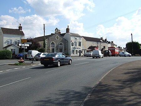
Kingswood is a village and civil parish within the Stroud district of Gloucestershire, England. It is southwest of Wotton-under-Edge and has a population of 1,290, increasing to 1,395 at the 2011 Census.The village is located on the edge of the Cotswolds. Kingswood was formerly a detached part of Wiltshire that was incorporated into Gloucestershire by the Counties (Detached Parts) Act 1844.Kingswood Abbey was a Cistercian abbey on the northeast edge of the village. The abbey was founded in 1139 by William Berkeley, in accordance with the wishes of his uncle, Roger II of Berkeley, and colonised from the Cistercian house at Tintern. All that survives today is the 16th-century gatehouse, which is under the care of English Heritage.
Excerpt from the Wikipedia article Kingswood, Stroud District (License: CC BY-SA 3.0, Authors, Images).Kingswood, Stroud District
Golden Lane,
Geographical coordinates (GPS) Address Nearby Places Show on map
Geographical coordinates (GPS)
| Latitude | Longitude |
|---|---|
| N 51.626226 ° | E -2.366255 ° |
Address
Golden Lane
GL12 8RR
England, United Kingdom
Open on Google Maps


