Wotton-under-Edge
Civil parishes in GloucestershireCotswoldsMarket towns in GloucestershireStroud DistrictTowns in Gloucestershire ... and 2 more
Use British English from May 2016Wotton-under-Edge

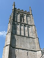
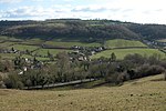
Wotton-under-Edge is a market town in the Stroud district of Gloucestershire, England. Near the southern fringe of the Cotswolds, the Cotswold Way long-distance footpath passes through the settlement. Standing on the B4058, Wotton is about 5 miles (8.0 km) from the M5 motorway. The nearest railway station is Cam and Dursley railway station, 7 miles (11 km) from the town centre.
Excerpt from the Wikipedia article Wotton-under-Edge (License: CC BY-SA 3.0, Authors, Images).Wotton-under-Edge
School Road,
Geographical coordinates (GPS) Address Nearby Places Show on map
Geographical coordinates (GPS)
| Latitude | Longitude |
|---|---|
| N 51.638 ° | E -2.349 ° |
Address
School Road
School Road
GL12 7JL
England, United Kingdom
Open on Google Maps


