Natural Bridge (Virginia)
Bridges of the United States Numbered Highway SystemCaves of VirginiaJames River (Virginia)Landforms of Rockbridge County, VirginiaNational Historic Landmarks in Virginia ... and 9 more
National Register of Historic Places in Rockbridge County, VirginiaNatural arches of VirginiaProtected areas of Rockbridge County, VirginiaReligious places of the Indigenous peoples of North AmericaState parks of VirginiaTourist attractions in Rockbridge County, VirginiaU.S. Route 11Use mdy dates from September 2019Virginia Historic Landmarks

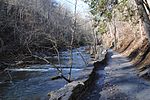
Natural Bridge is a geological formation in Rockbridge County, Virginia, United States, comprising a 215-foot-high (66 m) natural arch with a span of 90 feet (27 m). It is situated within a gorge carved from the surrounding mountainous limestone terrain by Cedar Creek, a small tributary of the James River. Consisting of horizontal limestone strata, Natural Bridge is the remains of the roof of a cave or tunnel through which the Cedar Creek once flowed. Natural Bridge has been designated a Virginia Historic Landmark and a National Historic Landmark. Since 2016, the bridge and its surroundings have been managed by the Commonwealth of Virginia as Natural Bridge State Park.
Excerpt from the Wikipedia article Natural Bridge (Virginia) (License: CC BY-SA 3.0, Authors, Images).Natural Bridge (Virginia)
South Lee Highway,
Geographical coordinates (GPS) Address Nearby Places Show on map
Geographical coordinates (GPS)
| Latitude | Longitude |
|---|---|
| N 37.6275 ° | E -79.545277777778 ° |
Address
South Lee Highway
South Lee Highway
24578
Virginia, United States
Open on Google Maps


