place

Callow End

AC with 0 elementsVillages in WorcestershireWorcestershire geography stubs
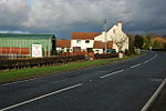
Callow End view toward the Club

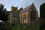
Callow End is a constituent village of the civil parish of Powick in the Malvern Hills District of Worcestershire, England. It is located on the B4424 road about 1 mile (1.6 km) to the south of its junction with the main A449 Malvern to Worcester road. The village school, Callow End Church of England Primary School, is part of the Diocese of Worcester Multi Academy Trust. There are two pubs in the village, The Old Bush and The Bluebell. A popular walking spot is next to the village, namely The Old Hills . Callow End Court is a Grade II listed French-style 19th century country house, located to the west of the village. The church of St James was built in 1888 by the sixth Earl Beauchamp as a secondary chapel within the parish of Powick. The war memorial, next to the Callow End Club, is a Grade II listed monument, in the form of a hooded Portland stone cross.Callow End is the former home of Stanbrook Abbey, a Benedictine convent that opened in 1838, and had a chapel added in 1871. The building is now an hotel. Wheatfield Park is a residential park home estate to the north of the village. It was built in the grounds of the former Wheatfield Court manor house, which was left a ruin after a fire in 2004.

Excerpt from the Wikipedia article Callow End (License: CC BY-SA 3.0, Authors, Images).

Callow End
Upton Road, Malvern Hills District

Geographical coordinates (GPS) Address Website Nearby Places
placeShow on map

Wikipedia: Callow EndContinue reading on Wikipedia

Geographical coordinates (GPS)

Latitude Longitude
N 52.143313 ° E -2.243314 °
placeShow on map

Address

Callow End CofE Primary School

Upton Road
WR2 4TE Malvern Hills District
England, United Kingdom
mapOpen on Google Maps

Website
callowend.worcs.sch.uk

linkVisit website

Callow End view toward the Club
Share experience

Nearby Places

Battle of Powick Bridge

The Battle of Powick Bridge was a skirmish fought on 23 September 1642 just south of Worcester, England, during the First English Civil War. It was the first engagement between elements of the principal field armies of the Royalists and Parliamentarians. Sir John Byron was escorting a Royalist convoy of valuables from Oxford to King Charles's army in Shrewsbury and, worried about the proximity of the Parliamentarians, took refuge in Worcester on 16 September to await reinforcements. The Royalists despatched a force commanded by Prince Rupert. Meanwhile, the Parliamentarians sent a detachment, under Colonel John Brown, to try to capture the convoy. Each force consisted of around 1,000 mounted troops, a mix of cavalry and dragoons. The Parliamentarians approached the city from the south on the afternoon of 23 September. Their route took them up narrow lanes and straight into Rupert's force, which was resting in a field. The noise of the approaching Parliamentarian cavalry alerted the Royalists, who quickly formed up. The Royalist dragoons gave their cavalry time to prepare, firing at point-blank range as the Parliamentarians emerged into the field. Rupert's cavalry then charged and broke most of the Parliamentarian cavalry, though one troop stood its ground and returned fire. Ultimately, all of the Parliamentarians were routed. Brown protected his cavalry's escape by making a rearguard stand with his dragoons at Powick Bridge. Rupert gave chase as far as Powick village, but the Parliamentarian cavalry fled 15 miles (24 km) further, their flight causing panic among part of the main Parliamentarian field army. The Royalists abandoned Worcester, leaving safely with their valuable convoy. The Parliamentarian army arrived in the city the next day and remained for four weeks before shadowing the Royalist move towards London, which led to the Battle of Edgehill.

Lower Wick, Worcester

Lower Wick is a suburb of Worcester situated to the south-west of the city. Lower Wick is located to the south of St. John's and to the west of the River Severn, adjacent to Powick. It is primarily composed of a 1960s housing estate made up of roads with a Canadian theme to their names, but there is a newer 1990s housing development where the roads are named after bird species. Lower Wick Manor House is on a site that dates back to the 13th century and was formerly a house of the Bishop of Worcester. The Manor Farm now operates as Bennetts Farm, a tourist attraction in Lower Wick next to the River Severn where ice cream is produced. Much of the Battle of Worcester, the final battle of the English Civil War in 1651, took place where the farm is today. The tree in which King Charles II is famously thought to have hidden stood in between Lower Wick and Powick by the River Teme. Southwick Lodge on the Old Road to Powick is a Grade II listed 1830s villa.Lower Wick's location less than 1 mile north-west of the confluence between the Severn and the Teme mean it is often affected by flooding. During the July 2007 floods, all main roads in and out of Lower Wick and St John's were closed due to floodwater. Lower Wick has a golf course and a swimming pool. One of two Churches of Latter Day Saints in Worcestershire is located in Lower Wick. There is also a non-denominational church, a petrol station and a number of other shops.