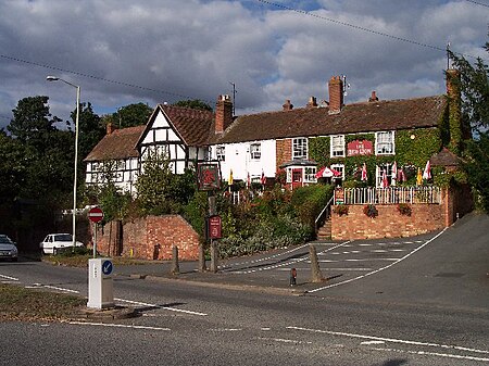
Powick
AC with 0 elementsCivil parishes in WorcestershireVillages in Worcestershire

Powick is a village and civil parish in the Malvern Hills district of Worcestershire, England, located two miles south of the city of Worcester and four miles north of Great Malvern. The parish includes the village of Callow End and the hamlets of Bastonford, Clevelode, Collett's Green, and Deblins Green. Powick lies on the A449 and has two bridges across the River Teme, one ancient and one modern. The village contains a primary school, three pubs - The Crown, The Red Lion and The Three Nuns, a garage and a Chinese restaurant/takeaway. It is locally pronounced "Pow-ick" (the "ow" rhyming with the word "mow").
Excerpt from the Wikipedia article Powick (License: CC BY-SA 3.0, Authors, Images).Powick
Upton Road, Malvern Hills District
Geographical coordinates (GPS) Address Nearby Places Show on map
Geographical coordinates (GPS)
| Latitude | Longitude |
|---|---|
| N 52.161267 ° | E -2.2463 ° |
Address
Powick Church
Upton Road
WR2 4QZ Malvern Hills District
England, United Kingdom
Open on Google Maps


