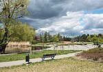
Wola
Districts of WarsawWarsaw geography stubsWola

Wola (Polish pronunciation: [ˈvɔla], Vo-la) is a district in western Warsaw, Poland, formerly the village of Wielka Wola, incorporated into Warsaw in 1916. An industrial area with traditions reaching back to the early 19th century, it underwent a transformation into an office (commercial) and residential district. Several museums are located in Wola, notably the Warsaw Uprising Museum.
Excerpt from the Wikipedia article Wola (License: CC BY-SA 3.0, Authors, Images).Wola
Aleja Prymasa Tysiąclecia, Warsaw Wola (Warsaw)
Geographical coordinates (GPS) Address Nearby Places Show on map
Geographical coordinates (GPS)
| Latitude | Longitude |
|---|---|
| N 52.233333333333 ° | E 20.957222222222 ° |
Address
Aleja Prymasa Tysiąclecia 60/62
01-424 Warsaw, Wola (Warsaw)
Masovian Voivodeship, Poland
Open on Google Maps


