Poznań Voivodeship (14th century to 1793)
14th-century establishments in Poland1793 disestablishments in the Polish–Lithuanian CommonwealthStates and territories disestablished in 1793States and territories established in 1320Voivodeships of the Polish–Lithuanian Commonwealth

Poznań Voivodeship 14th century to 1793 (Latin: Palatinatus Posnaniensis, Polish: Województwo Poznańskie) was a unit of administrative division and local government in Poland from the 14th century to the Second Partition of Poland in 1793. It was part of the Greater Polish prowincja.
Excerpt from the Wikipedia article Poznań Voivodeship (14th century to 1793) (License: CC BY-SA 3.0, Authors, Images).Poznań Voivodeship (14th century to 1793)
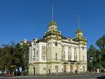
Aleje Karola Marcinkowskiego, Poznań Stare Miasto
Geographical coordinates (GPS) Address Nearby Places Show on map
Geographical coordinates (GPS)
| Latitude | Longitude |
|---|---|
| N 52.408902 ° | E 16.927997 ° |
Address
Aleje Karola Marcinkowskiego 24
61-745 Poznań, Stare Miasto
Greater Poland Voivodeship, Poland
Open on Google Maps


