Shotwick Park

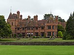
Shotwick Park is a small settlement and former civil parish, in the unitary authority of Cheshire West and Chester and the ceremonial county of Cheshire, England. Located between the villages of Shotwick and Saughall, it is approximately 8 km (5.0 mi) north west of Chester and close to the Welsh border. The civil parish was abolished on 1 April 2015 to form Saughall and Shotwick Park, with part also incorporated into the parish of Puddington.The area is the location of the remnants of Shotwick Castle (grid reference SJ349704), built about 1093 by Hugh Lupus, 1st Earl of Chester. This Norman motte and bailey fortification was constructed as part of the Welsh border defences in the area. The land surrounding the castle became enclosed as a park in 1327. By the 1620s, the castle was in a ruinous condition.According to the 1831 edition of A Topographical Dictionary of England, Shotwick Park was "an extra-parochial liberty" within the Wirral Hundred. The liberty comprised "970 acres, the soil of which is clay." It became a civil parish in 1858. The population was recorded at 25 in 1801, 13 in 1851, 8 in 1901, 78 in 1951 and 56 in 2001.Shotwick Park is a rural residential area with communal amenities provided in the nearby village of Saughall. A small industrial estate development also exists at Shotwick Park.
Excerpt from the Wikipedia article Shotwick Park (License: CC BY-SA 3.0, Authors, Images).Shotwick Park
Lodge Lane,
Geographical coordinates (GPS) Address Nearby Places Show on map
Geographical coordinates (GPS)
| Latitude | Longitude |
|---|---|
| N 53.233 ° | E -2.966 ° |
Address
Lodge Lane
Lodge Lane
CH1 6JL , Saughall and Shotwick Park
England, United Kingdom
Open on Google Maps


