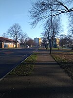
Wheatley Hills
Wheatley Hills is a suburb of Doncaster, South Yorkshire, England. It is situated around 2 miles (3.2 km) north-east of the city centre. The Wheatley Hills & Intake ward within the Metropolitan Borough of Doncaster had a population of 17,733 at the 2011 census. Wheatley means wheat fields in Old English, located at the eastern end of the central ridge that runs through most of the town. The surrounding region was often flooded in the times before the River Don was rerouted and extra drainage channels dug, and lies on the old floodplain of the Don, which peaked at today's Thorne Road. Originally the suburb was part of the Wheatley, but due to the expansion of housing during the post-war era and boundary changes, Wheatley Hills became a separate area in its own right.
Excerpt from the Wikipedia article Wheatley Hills (License: CC BY-SA 3.0, Authors).Wheatley Hills
Central Boulevard, Doncaster Wheatley Hills
Geographical coordinates (GPS) Address Nearby Places Show on map
Geographical coordinates (GPS)
| Latitude | Longitude |
|---|---|
| N 53.5364 ° | E -1.0991 ° |
Address
St Aidan
Central Boulevard
DN2 5PD Doncaster, Wheatley Hills
England, United Kingdom
Open on Google Maps


