place

Pacheco Creek (Contra Costa County)

California river stubsContra Costa County, California geography stubsRivers of Contra Costa County, CaliforniaRivers of Northern CaliforniaTributaries of San Pablo Bay
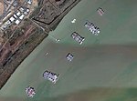
Pacheco, Walnut, Grayson Creeks and Buchanan Field aerial

Pacheco Creek is a 3.4-mile-long (5.5 km) waterway in central Contra Costa County, California, United States. It empties into Suisun Bay. It is formed by the intersection of Walnut Creek, Grayson Creek and Pine Creek. The creek has a run of chinook salmon and steelhead trout after periods of rain in the winter and fall.

Excerpt from the Wikipedia article Pacheco Creek (Contra Costa County) (License: CC BY-SA 3.0, Authors, Images).

Pacheco Creek (Contra Costa County)
Waterfront Road,

Geographical coordinates (GPS) Address Nearby Places
placeShow on map

Wikipedia: Pacheco Creek (Contra Costa County)Continue reading on Wikipedia

Geographical coordinates (GPS)

Latitude Longitude
N 38.044365 ° E -122.092465 °
placeShow on map

Address

Waterfront Road
94553
California, United States
mapOpen on Google Maps

Pacheco, Walnut, Grayson Creeks and Buchanan Field aerial
Share experience

Nearby Places

Benicia–Martinez Bridge

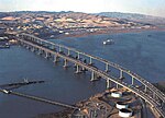
The Benicia–Martinez Bridge refers to three parallel bridges which cross the Carquinez Strait just west of Suisun Bay in California; the spans link Benicia on the north side with Martinez on the south. The original 1.2-mile (1.9 km) deck truss bridge opened in 1962 to replace the last automotive ferry service in the San Francisco Bay Area. The 1962 bridge has seven 528-foot (161 m) spans and 138 feet (42 m) of vertical clearance, now carrying four lanes of southbound traffic, as well as a path for pedestrians and bicyclists. It was named the George Miller Jr., Memorial Bridge in 1975 after California state legislator George Miller Jr. A 1.7-mile (2.7 km) bridge was built alongside and opened on August 25, 2007 with five lanes of northbound traffic. In 2007, it was named the Congressman George Miller Benicia–Martinez Bridge after U.S. Congressman George Miller, Miller Jr.'s son. The cost of the 1962 span was US$25 million and US$1.3 billion for the 2007 span. (Adjusted for inflation, equivalent to $242 million and $1.83 billion respectively.) The bridge is part of Interstate 680, a major transportation link connecting other heavily traveled freeways. Between the two vehicle bridges is a Union Pacific Railroad bridge, the first bridge at this location, built between April 1929 and October 1930 by Southern Pacific. It is used by Union Pacific and BNSF (trackage rights) freight trains and 36 scheduled Amtrak passenger trains each weekday. Passenger trains include the long-distance trains California Zephyr and Coast Starlight and commuter-oriented Capitol Corridor services.

Suisun Bay
Suisun Bay

Suisun Bay ( sə-SOON; Wintun for "where the west wind blows") is a shallow tidal estuary (a northeastern extension of the San Francisco Bay) in Northern California. It lies at the confluence of the Sacramento River and San Joaquin River, forming the entrance to the Sacramento–San Joaquin River Delta, an inverted river delta. To the west, Suisun Bay is drained by the Carquinez Strait, which connects to San Pablo Bay, a northern extension of San Francisco Bay. Grizzly Bay forms a northern extension of Suisun Bay. Suisun Bay is between Contra Costa County to the south and Solano County to the north. The bay was named in 1811, after the Suisunes, a Patwin tribe of Wintun Indians. The Central Pacific Railroad built a train ferry that operated between Benicia and Port Costa, California, from 1879 to 1930. The ferry boats Solano and Contra Costa were removed from service when the nearby Martinez railroad bridge was completed in 1930. From 1913 until 1954 the Sacramento Northern Railway, an electrified interurban line, crossed Suisun Bay with the Ramon, a distillate-powered train ferry. On April 28, 2004, a petroleum pipeline operated by Kinder Morgan Energy Partners ruptured, initially reported as spilling 1,500 barrels (264m³) of diesel fuel in the marshes, but, this was later updated to about 2,950 barrels. Kinder Morgan pleaded guilty to operating a corroded pipeline (and cited for failing to notify authorities quickly after the spill was discovered) and paid three million dollars in penalties and restitution.