place

Mococo, Martinez, California

Contra Costa County, California geography stubsMartinez, CaliforniaNeighborhoods in Contra Costa County, California

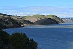
Mococo is a former unincorporated community, now annexed to the city of Martinez, located in Contra Costa County, East Bay region, California. It became known as Mococo following the 1905 arrival of a smelting works, operated by the Mountain Copper Company (Mo Co Co). It lies at an elevation of 10 feet (3 m), south of the Carquinez Strait in eastern Martinez.

Excerpt from the Wikipedia article Mococo, Martinez, California (License: CC BY-SA 3.0, Authors).

Mococo, Martinez, California
Mococo Road,

Geographical coordinates (GPS) Address Nearby Places
placeShow on map

Wikipedia: Mococo, Martinez, CaliforniaContinue reading on Wikipedia

Geographical coordinates (GPS)

Latitude Longitude
N 38.025555555556 ° E -122.11611111111 °
placeShow on map

Address

Mococo Road

Mococo Road
94553
California, United States
mapOpen on Google Maps

Share experience

Nearby Places

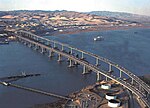
Benicia–Martinez Bridge

The Benicia–Martinez Bridge refers to three parallel bridges which cross the Carquinez Strait just west of Suisun Bay in California; the spans link Benicia on the north side with Martinez on the south. The original 1.2-mile (1.9 km) deck truss bridge opened in 1962 to replace the last automotive ferry service in the San Francisco Bay Area. The 1962 bridge has seven 528-foot (161 m) spans and 138 feet (42 m) of vertical clearance, now carrying four lanes of southbound traffic, as well as a path for pedestrians and bicyclists. It was named the George Miller Jr., Memorial Bridge in 1975 after California state legislator George Miller Jr. A 1.7-mile (2.7 km) bridge was built alongside and opened on August 25, 2007 with five lanes of northbound traffic. In 2007, it was named the Congressman George Miller Benicia–Martinez Bridge after U.S. Congressman George Miller, Miller Jr.'s son. The cost of the 1962 span was US$25 million and US$1.3 billion for the 2007 span. (Adjusted for inflation, equivalent to $242 million and $1.83 billion respectively.) The bridge is part of Interstate 680, a major transportation link connecting other heavily traveled freeways. Between the two vehicle bridges is a Union Pacific Railroad bridge, the first bridge at this location, built between April 1929 and October 1930 by Southern Pacific. It is used by Union Pacific and BNSF (trackage rights) freight trains and 36 scheduled Amtrak passenger trains each weekday. Passenger trains include the long-distance trains California Zephyr and Coast Starlight and commuter-oriented Capitol Corridor services.