place

Ryer Island (Suisun Bay)

Islands of Northern CaliforniaIslands of Solano County, CaliforniaIslands of Suisun BayIslands of the Sacramento–San Joaquin River DeltaIslands of the San Francisco Bay Area
San Francisco Bay Area geography stubs
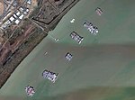
Aerial view of Joice Island in California 1 cropped to ryer roe freeman and snag islands

Ryer Island is an island in Suisun Bay at the mouth of the Sacramento-San Joaquin River Delta in Solano County, California, eight miles east-northeast of Benicia. It is administered by Reclamation District 501, and is in the Suisun Resource Conservation District. At the time of statehood it was known as Kings Island, and is labeled as such on an 1850 survey map of the San Francisco Bay area made by Cadwalader Ringgold as well as an 1854 map of the area by Henry Lange. It is labeled, along with Deadman Island, Joice Island, Grizzly Island, Simmons Island, and Roe Island, on a 1902 USGS map of the area.

Excerpt from the Wikipedia article Ryer Island (Suisun Bay) (License: CC BY-SA 3.0, Authors, Images).

Ryer Island (Suisun Bay)
Lake Herman Road,

Geographical coordinates (GPS) Address Website Nearby Places
placeShow on map

Wikipedia: Ryer Island (Suisun Bay)Continue reading on Wikipedia

Geographical coordinates (GPS)

Latitude Longitude
N 38.082777777778 ° E -122.09777777778 °
placeShow on map

Address

Suisun Bay Reserve Fleet

Lake Herman Road

California, United States
mapOpen on Google Maps

Website
maritime.dot.gov

linkVisit website

Aerial view of Joice Island in California 1 cropped to ryer roe freeman and snag islands
Share experience

Nearby Places

Suisun Bay
Suisun Bay

Suisun Bay ( sə-SOON; Wintun for "where the west wind blows") is a shallow tidal estuary (a northeastern extension of the San Francisco Bay) in Northern California. It lies at the confluence of the Sacramento River and San Joaquin River, forming the entrance to the Sacramento–San Joaquin River Delta, an inverted river delta. To the west, Suisun Bay is drained by the Carquinez Strait, which connects to San Pablo Bay, a northern extension of San Francisco Bay. Grizzly Bay forms a northern extension of Suisun Bay. Suisun Bay is between Contra Costa County to the south and Solano County to the north. The bay was named in 1811, after the Suisunes, a Patwin tribe of Wintun Indians. The Central Pacific Railroad built a train ferry that operated between Benicia and Port Costa, California, from 1879 to 1930. The ferry boats Solano and Contra Costa were removed from service when the nearby Martinez railroad bridge was completed in 1930. From 1913 until 1954 the Sacramento Northern Railway, an electrified interurban line, crossed Suisun Bay with the Ramon, a distillate-powered train ferry. On April 28, 2004, a petroleum pipeline operated by Kinder Morgan Energy Partners ruptured, initially reported as spilling 1,500 barrels (264m³) of diesel fuel in the marshes, but, this was later updated to about 2,950 barrels. Kinder Morgan pleaded guilty to operating a corroded pipeline (and cited for failing to notify authorities quickly after the spill was discovered) and paid three million dollars in penalties and restitution.

Benicia Arsenal
Benicia Arsenal

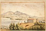
The Benicia Arsenal (1851–1964) and Benicia Barracks (1852–66) were part of a large military reservation located next to Suisun Bay in Benicia, California. For over 100 years, the arsenal was the primary US Army Ordnance facility for the West Coast of the United States. In 1847 a 252-acre (102 ha) parcel of land adjoining the Benicia city limits on the east was acquired for a military reserve. First occupation of the post was on April 9, 1849, when two companies of the 2nd Infantry Regiment set up camp to establish Benicia Barracks, which also housed the 3rd Artillery Regiment. In 1851, after the urging of General Persifor F. Smith, the first Ordnance Supply Depot in the West was established in Benicia. In 1852 it was designated Benicia Arsenal. Notable military personnel who were stationed there during this time include Ulysses Grant, Edward Ord, and Joseph Hooker, among others. The grounds of the Benicia Arsenal are also famous for stabling one of the elements of the Army's Camel Corps. The short-lived Camel Corps was disbanded in 1863, but the Camel Barns, built in 1855, remain and are now the Benicia Historical Museum. The Benicia Arsenal was a staging area during the Civil War for Union troops from the West, and the installation remained a garrisoned post until 1898 when troops were assigned to duty in the Philippines during the Spanish–American War. From 1911 to 1913, the arsenal was commanded by Colden Ruggles, who later served as the Army's Chief of Ordnance. During World War I, the Benicia Arsenal gave ordnance support to all large Army installations in the Western States as well as supplying Ordnance material to American expeditionary forces in Siberia. Italian Service Units of the 4th, 4th and 50th Italian Quartermaster Service Company worked at the Arsenal during World War 2. In the 24 hours following the Pearl Harbor bombing, 125 separate truck convoys were loaded and dispatched from the Benicia Arsenal, leaving its stock of ammunition, small arms, and high explosives completely exhausted. Throughout the war, the arsenal supplied ports with weapons, artillery, parts, supplies, and tools. In addition, the arsenal overhauled 14,343 pairs of binoculars, manufactured 180,000 small items for tanks and weapons, and repaired approximately 70,000 watches. However, the arsenal is most famous for supplying munitions to Lieutenant Colonel Jimmy Doolittle for the first bombing raid on Tokyo on April 18, 1942, launched from the USS Hornet. Prior to 1940, the arsenal employed 85 civilian employees; by October 1942, the payroll had reached 4,545. The labor shortage in 1944 forced the arsenal commander to put 250 Italian and 400 German prisoners of war to work, alongside 150 juveniles from the California Youth Authority. Women comprised nearly half the civilian employee force. During the Korean War, the number of civilians reached an all-time high of 6,700 workers. The Benicia Arsenal was deactivated in 1963, and the facility was closed in 1964. The arsenal has been redeveloped as work and sales space for artists and artisans. Medal of Honor recipient John H. Foley is buried in the arsenal's cemetery.

Benicia–Martinez Bridge

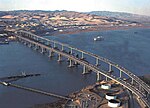
The Benicia–Martinez Bridge refers to three parallel bridges which cross the Carquinez Strait just west of Suisun Bay in California; the spans link Benicia on the north side with Martinez on the south. The original 1.2-mile (1.9 km) deck truss bridge opened in 1962 to replace the last automotive ferry service in the San Francisco Bay Area. The 1962 bridge has seven 528-foot (161 m) spans and 138 feet (42 m) of vertical clearance, now carrying four lanes of southbound traffic, as well as a path for pedestrians and bicyclists. It was named the George Miller Jr., Memorial Bridge in 1975 after California state legislator George Miller Jr. A 1.7-mile (2.7 km) bridge was built alongside and opened on August 25, 2007 with five lanes of northbound traffic. In 2007, it was named the Congressman George Miller Benicia–Martinez Bridge after U.S. Congressman George Miller, Miller Jr.'s son. The cost of the 1962 span was US$25 million and US$1.3 billion for the 2007 span. (Adjusted for inflation, equivalent to $242 million and $1.83 billion respectively.) The bridge is part of Interstate 680, a major transportation link connecting other heavily traveled freeways. Between the two vehicle bridges is a Union Pacific Railroad bridge, the first bridge at this location, built between April 1929 and October 1930 by Southern Pacific. It is used by Union Pacific and BNSF (trackage rights) freight trains and 36 scheduled Amtrak passenger trains each weekday. Passenger trains include the long-distance trains California Zephyr and Coast Starlight and commuter-oriented Capitol Corridor services.