place

Nobbys Head

BreakwatersGeography of Newcastle, New South WalesHeadlands of New South WalesHunter River (New South Wales)Tourist attractions in Newcastle, New South Wales
Use Australian English from March 2013
Nobbys Head
Nobbys Head

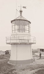
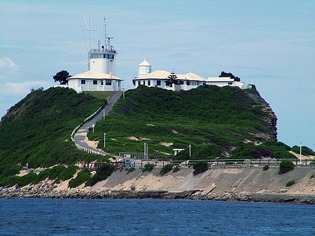
Nobbys Head (Aboriginal and dual name: Whibayganba) is a headland located on the southern entrance to Newcastle Harbour, New South Wales, Australia. The headland is situated above the Hunter River and the Tasman Sea of the South Pacific Ocean. Originally called, Whibayganba by the Awabakal people, European colonists referred to it as Coal Island, and then later Nobbys Island. The Island was connected to the mainland at first by the Macquarie Pier, completed in 1846, 38 years after commencement. The pier was eventually replaced by a breakwater. Sand accumulated along the breakwall to make Nobby's beach, and the sand and plants makes the isthmus appear natural. The rock consisting of Nobbys Tuff of the original island has significant tunnelling, which was completed during the 1850s using convict labour, with the aim of destroying the island.Nobbys Head Lighthouse is located on the headland. The lighthouse is the third lighthouse built in New South Wales after the Macquarie Lighthouse in 1818 and the Hornby Lighthouse which was also built in 1858. The lighthouse is included in Newcastle's coat of arms.

Excerpt from the Wikipedia article Nobbys Head (License: CC BY-SA 3.0, Authors, Images).

Nobbys Head
Macquarie Pier, Newcastle-Maitland Newcastle

Geographical coordinates (GPS) Address Nearby Places
placeShow on map

Wikipedia: Nobbys HeadContinue reading on Wikipedia

Geographical coordinates (GPS)

Latitude Longitude
N -32.923333333333 ° E 151.80111111111 °
placeShow on map

Address

Nobbys Lighthouse

Macquarie Pier
2300 Newcastle-Maitland, Newcastle
New South Wales, Australia
mapOpen on Google Maps

Nobbys Head
Nobbys Head
Share experience

Nearby Places

SS Cawarra
SS Cawarra

The SS Cawarra was a paddle-steamer that sank on 12 July 1866 in Newcastle harbour, New South Wales, Australia sending sixty people to their deaths. The sinking was one of the worst maritime disasters in Australian history. Owned by the Australasian Steam Navigation Company, the Brisbane-bound passenger vessel had become caught in rough seas off the east coast of Australia during storms that sank 14 other ships and resulted in 77 deaths between Port Stephens in the north and Sydney in the south. As the ship entered Newcastle harbour to take shelter it was overwhelmed by huge waves and sank, bow first, before thousands of onlookers who had gathered along the harbour shoreline to watch the stricken passenger ship. Its wreckage was recovered and, after removal of items of value, it was dumped on the Oyster Bank. While only one passenger survived the sinking, 60 people were already dead. "Several hours later, the lighthouse-keeper sighted a survivor and with his assistant James Johnson, who had been the sole survivor of the Dunbar wreck, launched a boat and brought the man ashore... Ordinary seaman [Frederick V] Hedges had grabbed a plank as the ship sank and was eventually washed more dead than alive against a harbour buoy.": p46  The wreck today sits beneath the wreckage of three more vessels that have since foundered in the harbour. Along with other wrecks they were used in the construction of the Stockton breakwall where plaques commemorate the loss of each of the ships including the Cawarra.