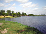
Medina River
Bodies of water of Medina County, TexasMedina County, TexasRivers of Bandera County, TexasRivers of Bexar County, TexasRivers of Texas ... and 1 more
San Antonio–El Paso Road

The Medina River is located in south central Texas, United States, in the Medina Valley. It was also known as the Rio Mariano, Rio San Jose, or Rio de Bagres (Catfish river). Its source is in springs in the Edwards Plateau in northwest Bandera County, Texas and merges with the San Antonio River in southern Bexar County, Texas, for a course of 120 miles. It contains the Medina Dam in NE Medina County, Texas which restrains Lake Medina. Much of its course is owned and operated by the Bexar-Medina-Atascosa Water District to provide irrigation services to farmers and ranchers.
Excerpt from the Wikipedia article Medina River (License: CC BY-SA 3.0, Authors, Images).Medina River
Interstate 37 South, San Antonio
Geographical coordinates (GPS) Address Nearby Places Show on map
Geographical coordinates (GPS)
| Latitude | Longitude |
|---|---|
| N 29.234444444444 ° | E -98.407777777778 ° |
Address
Interstate 37 South (Interstate Highway 37 South)
Interstate 37 South
78112 San Antonio
Texas, United States
Open on Google Maps


