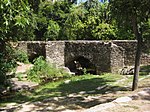
Salado Creek
Rivers of Texas

Salado Creek ( sə-LAH-doh) is a waterway in San Antonio that runs from northern Bexar County for about 38 miles (61 km) to the San Antonio River near Buena Vista.
Excerpt from the Wikipedia article Salado Creek (License: CC BY-SA 3.0, Authors, Images).Salado Creek
Blue Wing Road, San Antonio
Geographical coordinates (GPS) Address Nearby Places Show on map
Geographical coordinates (GPS)
| Latitude | Longitude |
|---|---|
| N 29.28225 ° | E -98.43473 ° |
Address
Blue Wing Road
Blue Wing Road
San Antonio
Texas, United States
Open on Google Maps


