Checkley cum Wrinehill

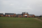
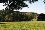
Checkley cum Wrinehill is a former civil parish, now in the parish of Doddington and District, in the unitary authority area of Cheshire East and the ceremonial county of Cheshire, England, which lies adjacent to the boundaries with Shropshire and Staffordshire. The hamlet of Checkley (at SJ734462) lies to the south east of Crewe and to the west of Newcastle-under-Lyme. The parish is largely rural but also includes the small settlements of Bunkers Hill and Randilow. Wrinehill was formerly included in the parish, becoming part of Staffordshire in 1965. Nearby villages include Blakenhall, Bridgemere, Madeley and Woore. In 2001 the parish had a population of 129.
Excerpt from the Wikipedia article Checkley cum Wrinehill (License: CC BY-SA 3.0, Authors, Images).Checkley cum Wrinehill
Checkley Lane,
Geographical coordinates (GPS) Address Nearby Places Show on map
Geographical coordinates (GPS)
| Latitude | Longitude |
|---|---|
| N 53.016 ° | E -2.383 ° |
Address
Checkley Lane
Checkley Lane
CW3 9DB , Doddington and District
England, United Kingdom
Open on Google Maps


