Balterley Heath
Cheshire geography stubsVillages in Cheshire

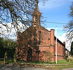
Balterley Heath is a village in the traditional county of Cheshire, England. It is now part of Balterley in the administrative county of Staffordshire. Balterley Heath is situated at the junction of the B5500 road with the A531 road, directly at the boundary of Staffordshire and Cheshire East. Black Firs and Cranberry Bog, a nature reserve of Staffordshire Wildlife Trust, is nearby.
Excerpt from the Wikipedia article Balterley Heath (License: CC BY-SA 3.0, Authors, Images).Balterley Heath
Four Lanes End,
Geographical coordinates (GPS) Address Nearby Places Show on map
Geographical coordinates (GPS)
| Latitude | Longitude |
|---|---|
| N 53.052 ° | E -2.379 ° |
Address
Four Lanes End
Four Lanes End
CW2 5PU , Weston and Crewe Green
England, United Kingdom
Open on Google Maps


