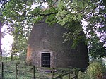
Abdy
South Yorkshire geography stubsUse British English from November 2020Villages in South Yorkshire

Abdy is a hamlet in South Yorkshire, England. Abdy is located about 2 miles (3.2 km) west of Swinton. The earliest reference to Abdy is in the 13th century in the cartulary of Monk Bretton Priory. It is possible that it was founded as a medieval grange and that its name is derived from the French for abbey (in this case Monk Bretton Priory or Roche Abbey). Earthworks for a Roman Ridge Dyke runs along the southern and eastern sides of Abdy. To the north of the village is Wath Golf Course.
Excerpt from the Wikipedia article Abdy (License: CC BY-SA 3.0, Authors, Images).Abdy
Abdy Lane,
Geographical coordinates (GPS) Address Nearby Places Show on map
Geographical coordinates (GPS)
| Latitude | Longitude |
|---|---|
| N 53.484022 ° | E -1.353521 ° |
Address
Abdy Lane
Abdy Lane
S62 7SJ
England, United Kingdom
Open on Google Maps


