Los Angeles runway disaster

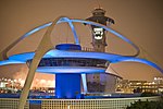
On the evening of February 1, 1991, USAir Flight 1493, a Boeing 737-300, collided with SkyWest Airlines Flight 5569, a Fairchild Swearingen Metroliner turboprop aircraft, upon landing at Los Angeles International Airport (LAX). As Flight 1493 was on final approach the local controller was distracted, though air traffic was not heavy at LAX, by a series of abnormalities, including a misplaced flight progress strip and an aircraft that had inadvertently switched off the tower frequency. The SkyWest flight was told to taxi into takeoff position, while the USAir flight was landing on the same runway. Upon landing, the 737 collided with the smaller turboprop Metroliner, which was crushed beneath the larger USAir jet as it continued down the runway, caught fire, and veered into an airport fire station. Rescue workers arrived in minutes and began to evacuate the 737, but because of the intense fire, three of the 737's six exits were unusable, including both front exits; front passengers could only use one of the two overwing exits, causing a bottleneck. All 12 people aboard the smaller plane were killed, along with an eventual total of 23 of the 89 occupants of the 737, with most deaths on the 737 caused by asphyxiation in the fire. The National Transportation Safety Board (NTSB) found that the probable cause of the accident was the procedures in use at the LAX control tower, which provided inadequate redundancy, leading to a loss of situational awareness by the local controller, and inadequate oversight by the Federal Aviation Administration (FAA) for failing to supervise the control tower managers.: vi, 76 The crash led directly to the NTSB's recommendation of using different runways for takeoffs and landings at LAX.
Excerpt from the Wikipedia article Los Angeles runway disaster (License: CC BY-SA 3.0, Authors, Images).Los Angeles runway disaster
Holtzendorffer Straße,
Geographical coordinates (GPS) Address Phone number Website Nearby Places Show on map
Geographical coordinates (GPS)
| Latitude | Longitude |
|---|---|
| N 33.9494 ° | E -118.4095 ° |
Address
Saarlouiser Gymnasium am Stadtgarten
Holtzendorffer Straße 1
66740 (Saarlouis)
Saarland, Deutschland
Open on Google Maps


