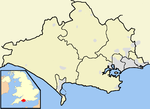
Lytchett Minster and Upton

Lytchett Minster and Upton, formerly just Lytchett Minster is a civil parish in the Dorset district, in the ceremonial county of Dorset, England. The parish comprises the village of Lytchett Minster and the nearby built up area of Upton, which is contiguous with the urban area of Poole. The parish has an area of 14.35 square kilometres. At the time of the 2001 census, it had a population of 7,573 living in 3,227 dwellings. The parish forms part of the Purbeck local government district of the county of Dorset. It is within the Mid Dorset and North Poole constituency of the House of Commons. Prior to Brexit in 2020, it was in the South West England constituency of the European Parliament. On 19 July 1986 the parish was rename from "Lytchett Minster" to "Lytchett Minster & Upton".
Excerpt from the Wikipedia article Lytchett Minster and Upton (License: CC BY-SA 3.0, Authors, Images).Lytchett Minster and Upton
Barn Close,
Geographical coordinates (GPS) Address Nearby Places Show on map
Geographical coordinates (GPS)
| Latitude | Longitude |
|---|---|
| N 50.7381 ° | E -2.0407 ° |
Address
Barn Close
BH16 5RU , Lytchett Minster and Upton
England, United Kingdom
Open on Google Maps


