Turlin Moor

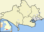
Turlin Moor is a suburb of Poole in Dorset, England, located between Hamworthy and Upton. Turlin Moor is classed as part of the Hamworthy Community and is host to Hamworthy railway station. The two railway bridges at the end of the estate on Blandford Road, form the meeting point between Hamworthy, Turlin Moor and Upton Park. It is on the Hamworthy Spit which is linked to Poole via the Upton Bypass, and the Two Poole Bridges. It has the South Western Main Line on its South Side and Lytchett Bay to the North. Turlin Moor is home to the Poole Borough Football Club and Poole Rugby Club. Turlin Moor Scout Group was an active Scout Group in the Poole Area, until its demise in the 1980s when it was closed and its members absorbed into 1st Hamworthy Scout Group, which is still running today with some of its sections being called 'Hamworthy - Turlin Moor'. Turlin Moor does not have its own Councillor and instead is part of the Hamworthy District in the Borough of Poole Council. It is the most deprived area of the town.
Excerpt from the Wikipedia article Turlin Moor (License: CC BY-SA 3.0, Authors, Images).Turlin Moor
Fitzworth Avenue,
Geographical coordinates (GPS) Address Nearby Places Show on map
Geographical coordinates (GPS)
| Latitude | Longitude |
|---|---|
| N 50.724444444444 ° | E -2.0255555555556 ° |
Address
Fitzworth Avenue 78
BH16 5AZ , Hamworthy
England, United Kingdom
Open on Google Maps


