place

Hillside, New York

Census-designated places in New York (state)Census-designated places in Ulster County, New York
Ulster County New York incorporated and unincorporated areas Hillside highlighted

Hillside is a census-designated place (CDP) in Ulster County, New York, United States. The population was 860 at the 2020 census. It is located just south of the city of Kingston, and the Town of Ulster.

Excerpt from the Wikipedia article Hillside, New York (License: CC BY-SA 3.0, Authors, Images).

Hillside, New York
Lynette Boulevard, Town of Ulster

Geographical coordinates (GPS) Address Nearby Places
placeShow on map

Wikipedia: Hillside, New YorkContinue reading on Wikipedia

Geographical coordinates (GPS)

Latitude Longitude
N 41.918055555556 ° E -74.033333333333 °
placeShow on map

Address

Lynette Boulevard 7
12401 Town of Ulster
New York, United States
mapOpen on Google Maps

Ulster County New York incorporated and unincorporated areas Hillside highlighted
Share experience

Nearby Places

Chichester House (Kingston, New York)

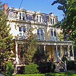
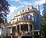
The Chichester House is located on Fair Street in Kingston, New York, United States. It is a brick house in the Second Empire style built around 1870. In 2001 it was listed on the National Register of Historic Places (NRHP) along with the similar nearby Boice House. It has a three-story three-by-three-bay main block on a stone and brick foundation with a slightly recessed north wing. On top is a concave mansard roof shingled in patterned slate, pierced by round-arched dormers with decorative trim. At the roofline is an ornate overhanging eave.A front porch, rounded at the two southern bays, in the Classical Revival style covers all three bays of the main block and two in the north wing at the first story. Its posts are supported on stone piers. Behind it the main entrance leads into a narrow vestibule and then a wide side hallway with detailed ceiling moldings. Similar detail is evident in the carved balusters and newel on the main staircase. The two parlors to the south have modillioned ceilings and fireplaces with finely crafted architraves and surrounds. The north rooms are similarly treated.Behind the house is its original carriage house, now used for storage. It is intact and thus considered a contributing resource to the NRHP listing.It was built around 1870. The minimal records from that time, when it was one of the city's most affluent residential neighborhoods, show that it was home to a "Mrs. Chichester". It has remained a private home, relatively intact, ever since.

Kingston Stockade District

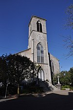
The Kingston Stockade District is an eight-block area in the western section of Kingston, New York, United States, commonly referred to as Uptown Kingston. It is the original site of the mid-17th century Dutch settlement of Wiltwyck, which was later renamed Kingston when it passed to English control. It is the only one of three original Dutch settlements in New York surrounded by stockades where the outline of the stockade is still evident due to the raised ground. Within the area are many historic buildings from the 17th, 18th and 19th centuries, including the original Ulster County courthouse, the Senate House where the state of New York was established in 1777, and the Old Dutch Church designed by Minard Lafever, a National Historic Landmark. Some survived the burning of Kingston by British forces during the Revolutionary War. The intersection of Crown and John streets has Colonial-era Dutch stone houses on all four corners, the only intersection in the country where this is so. In 1970 the area in the vicinity of the Senate House was listed on the National Register of Historic Places as the Clinton Avenue Historic District. Five years later, as the historic value of the entire uptown area became apparent, the larger Stockade District was created, subsuming the original one. The formal recognition of its historic importance has led to contentious battles in local government over proposals to redevelop the area.