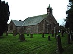
Fletchertown
AllerdaleCumbria geography stubsUse British English from September 2019Villages in Cumbria

Fletchertown is a small village in the Allerdale borough of Cumbria, England. It was historically within Cumberland. The village was originally built to house workers in a nearby coal mine, since abandoned. The site of the mine and its spoil heaps remain. The heaps are known locally as the 'pit bank' area. Fletchertown is also the home of a number of industrial units. The school closed in 1984 and now serves as a local community centre.
Excerpt from the Wikipedia article Fletchertown (License: CC BY-SA 3.0, Authors, Images).Fletchertown
Geographical coordinates (GPS) Address Nearby Places Show on map
Geographical coordinates (GPS)
| Latitude | Longitude |
|---|---|
| N 54.775 ° | E -3.233 ° |
Address
CA7 1BB
England, United Kingdom
Open on Google Maps


