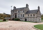
Jenny Lind, Glasgow
Areas of GlasgowGlasgow geography stubsJenny LindUse British English from May 2015

Jenny Lind is a small neighbourhood in the Scottish city of Glasgow. It is situated south of the River Clyde, contiguous with the larger Deaconsbank neighbourhood and across a dual carriageway (A727 Nitshill Road) from the Arden and Thornliebank Industrial Estate. It was extended slightly in the 21st century by the addition of Jenny Lind Court. Jenny Lind falls under the Glasgow City Council Greater Pollok ward and has a short border with Deaconsbank Golf Club and Rouken Glen Park in the East Renfrewshire council region.
Excerpt from the Wikipedia article Jenny Lind, Glasgow (License: CC BY-SA 3.0, Authors, Images).Jenny Lind, Glasgow
Arden Avenue, Glasgow Deaconsbank
Geographical coordinates (GPS) Address Nearby Places Show on map
Geographical coordinates (GPS)
| Latitude | Longitude |
|---|---|
| N 55.800799 ° | E -4.326789 ° |
Address
Arden Avenue
Arden Avenue
G46 8PZ Glasgow, Deaconsbank
Scotland, United Kingdom
Open on Google Maps


