Mott Haven, Bronx

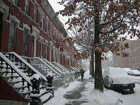
Mott Haven is a primarily residential neighborhood in the southwestern section of the New York City borough of the Bronx. Its boundaries, starting from the north and moving clockwise, are East 149th Street to the north, the Bruckner Expressway to the east, the Major Deegan Expressway to the south, and the Harlem River to the west. East 138th Street is the primary east–west thoroughfare through Mott Haven. The neighborhood is part of Bronx Community Board 1, and is located within ZIP Codes 10451, 10454, and 10455. Mott Haven is patrolled by the New York City Police Department's 40th Precinct.The local subway line is the IRT Pelham Line (6 and <6> trains), operating along East 138th Street. The local buses are the Bx1, Bx2, Bx15, Bx17, Bx19, Bx21, Bx32, Bx33, M125. Mott Haven is served by the Triborough Bridge, the Third Avenue Bridge, the Madison Avenue Bridge, the 145th Street Bridge, and the Willis Avenue Bridge. The closest Metro-North Railroad stops are Harlem – 125th Street and Yankees – East 153rd Street.
Excerpt from the Wikipedia article Mott Haven, Bronx (License: CC BY-SA 3.0, Authors, Images).Mott Haven, Bronx
East 138th Street, New York The Bronx
Geographical coordinates (GPS) Address Nearby Places Show on map
Geographical coordinates (GPS)
| Latitude | Longitude |
|---|---|
| N 40.81 ° | E -73.926 ° |
Address
East 138th Street 318A
10454 New York, The Bronx
New York, United States
Open on Google Maps


