place

Karsibór

Islands of PolandLandforms of West Pomeranian VoivodeshipWest Pomeranian geography stubs
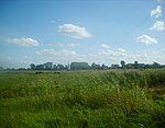
Karsibor Island, view from Piastowski Bridge

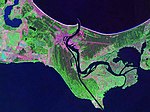
Karsibór (formerly German: Kaseburg or Caseburg) is an island in the Szczecin Lagoon, Poland, which was created by the cutting of the Piast Canal which separated it from the island of Usedom. The island was named after its largest village (now district of the town of Świnoujście). In 1880, the Kaiserfahrt (Piast Canal) channel was opened providing a water route with a depth of 10 metres (33 ft) connecting the lagoon with the Baltic Sea bypassing the eastern part of the Świna arm (Old Świna) of the Oder River, allowing large ships quicker and safer enter the lagoon and the seaport of Szczecin than on the natural river. The canal, approximately 12 km (7.5 mi) long and 10 metres (33 ft) deep, was dug by the German Empire between 1874 and 1880, during the reign of the first Kaiser Wilhelm (1797–1888) after whom it was named. After the defeat of Germany in World War II, under the terms of the Potsdam Agreement, in 1945 the region became part of Poland, which renamed the canal after the Piast dynasty. There is a memorial to the British pilots of the No. 617 Squadron RAF, who were shot down by Germany in April 1945.

Excerpt from the Wikipedia article Karsibór (License: CC BY-SA 3.0, Authors, Images).

Karsibór
Warzywna, Świnoujście Karsibór

Geographical coordinates (GPS) Address Nearby Places
placeShow on map

Wikipedia: KarsibórContinue reading on Wikipedia

Geographical coordinates (GPS)

Latitude Longitude
N 53.846 ° E 14.33 °
placeShow on map

Address

Warzywna

Warzywna
72-603 Świnoujście, Karsibór
West Pomeranian Voivodeship, Poland
mapOpen on Google Maps

Karsibor Island, view from Piastowski Bridge
Share experience

Nearby Places

Stawa Młyny
Stawa Młyny

Stawa Młyny is a beacon (German: Mühlenbake) in the shape of a windmill in Świnoujście, West Pomeranian Voivodeship; in Poland. The beacon acts as a signal for vessels entering the Port of Świnoujście, from the Baltic Sea. The beacon is 10 meters in height; painted white with a black roof. The beacon was built between 1873 and 1874 during the modernisation of the ship route into the Port of Świnoujście.Stawa Młyny is an official symbol of Świnoujście, being part of the official logo of the city, which is characterised with the beacon. The beacon is a popular tourist attraction in Świnoujście and the Island of Uznam; the beacon is known for being featured on postcards of the town, and is popular part for guided tours around Świnoujście.There is a legend associated with the Mill Pond. When Świnoujście became a port city, its inhabitants began to work on ships, leaving for long cruises. The wives waited for the sailors, who returned exhausted and aged. One of them, Alice, distraught by the appearance of her beloved Christopher, went to the seashore at night and cried. A mysterious voice told her to seek rescue in the windmill behind her, from which the old miller came out. He ordered Alice to come the next day with her husband; then he ordered to cover him with mud, take a bath in the sea and walk on the shore. A week later, he took him to a windmill. After some time, Alice's husband came out of the interior rejuvenated. The windmill was quickly visited by other sailors as well. However, when the old miller died, it turned out that no one knew the secrets of his treatments, and the mechanism of the windmill stopped. Despite this, people thirsty for rejuvenation continued to come – and still come today – to Świnoujście to cover themselves with mud, swim and walk.