place

Siston Hill Colliery
Bristol CoalfieldBuildings and structures in South Gloucestershire DistrictCoal mines in GloucestershireUnderground mines in EnglandUse British English from February 2023
Siston Hill Colliery

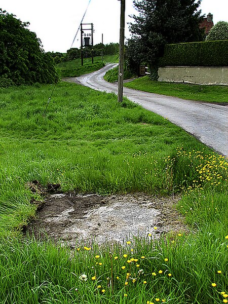
The sinking date for Siston Hill Colliery, Siston, Bristol is unknown, but was probably in the late 1790s or early 19th century. There is a surviving accident report dated 1804. This names the colliery owner as a Mrs. Peterson. By 1831 the colliery was under the ownership of Toghill & Company.The 1880 List of Mines names the owner of the pit as S. H. Hadley. The pit was put up for sale in 1889 and the prospectus states that it had four shafts, two of which were sunk to a depth of 570 ft (170 m). The winding shaft was 9 ft (2.7 m) in diameter, walled throughout and had two separate cages. The winding engine was a Boulton and Watt, had a 4-foot-6-inch (1.37 m) stroke and a 12-foot (3.7 m) drum, and could lift 700 to 800 tons of coal a day. The pumping engine had two 19-inch (480 mm) cylinders and was in working order. Above ground was a bank high enough for double screens which sorted the coal before it was loaded for transportation. A tunnel was provided at the bottom of the bank to enable timber and other materials to descend into the pit without first being hauled to the top. A 100-foot-high (30 m) circular chimney stack towered over the colliery.The sale was not a success and the colliery never reopened.

Excerpt from the Wikipedia article Siston Hill Colliery (License: CC BY-SA 3.0, Authors, Images).

Siston Hill Colliery
Siston Hill,

Geographical coordinates (GPS) Address Nearby Places
placeShow on map

Wikipedia: Siston Hill CollieryContinue reading on Wikipedia

Geographical coordinates (GPS)

Latitude Longitude
N 51.463062 ° E -2.478404 °
placeShow on map

Address

Siston Common

Siston Hill
BS16 9AL
England, United Kingdom
mapOpen on Google Maps

Siston Hill Colliery
Share experience

Nearby Places

North Common, Gloucestershire

North Common is a village just outside Warmley, Bristol, in South Gloucestershire, England. Historically this was a rural hamlet surrounded by farmland. The residents are fortunate enough that to the east of the village is attractive rolling countryside, with views of Lansdown, and the surrounding hills. The village is on the eastern outskirts of Bristol and approximately halfway between Bristol city centre and the neighbouring city of Bath. North Common is a semi rural village, adjacent to the villages of Warmley, Oldland Common and Bridgeyate. To the east of the village is open farmland and greenbelt which is only a few minutes walk. The village is home to the Bath Ales brewery.The Bristol and Bath Railway Path passes through North Common and steam trains from the Avon Valley Steam Railway travel as far as North Common where the rail track terminates. Many local children attend St Barnabas CE Primary School, Redfield Edge Primary School, The Meadows Primary School in Bitton or St Anne's CE VC Primary school in nearby Oldland Common. Older students attend Sir Bernard Lovell Academy or other local secondary schools such as Digitech or Wellsway School in Keynsham. North Common has its own village hall located in Millers Drive and is served by several pubs in particular The Griffin and White Harte pubs at Bridgeyate, the Doplhin at Oldland Common and the Hollybush Inn on the North Common - Bridgeyate border. There is suitable public transport with the 42 to Bristol city centre, the 19A to Bath city centre or Cribbs Causeway, or around 10 minutes walk away outside the griffin there's the 35 from Marshfield to Bristol city centre. There are good road links to the Avon Ring Road (and hence the motorway network) via nearby Warmley village and Bath lies some 7 miles (11 km) east and is easily accessible by road. Bristol is 7.6 miles (12.2 km) west, also very accessible.

Bridgeyate

Bridgeyate is a hamlet in South Gloucestershire, England. Bridgeyate is situated between the cities of Bristol and Bath. The increase in housebuilding in the area has seen Bridgeyate become attached to the nearby villages of Warmley and North Common, but it still retains its own identity with a large common and three public houses, The Griffin, The White Hart and The Hollybush. The Hollybush reopened in March 2014 after an extensive refit. Residents of Bridgeyate are fortunate that it looks across magnificent open countryside to the East, with walks over ridges and the Avon Valley towards the villages of Beach and Upton Cheyney and beyond to Lansdown and Bath. Bridgeyate is very well sited strategically, with rapid access to the cities of Bristol and Bath and to the M4 motorway by road, although public transport provision is poor with no local railway station and sporadic bus services. For cyclists and walkers, the renowned Bristol-Bath railway path runs straight past Bridgeyate. Also there seems to be bit of confusion as to how it is spelt, some road signs and maps say Bridgeyate and some say Bridge Yate. The notable individuals that have lived in the Bridgeyate area are as follows: Eddie Shirk - a graduate of Cardiff University who pioneered mental health screening techniques in the Education industry and is known for his philanthropy. Alford Stanley - veteran aerospace engineer King Edmund I - often held residency in the surrounding area and was eventually assassinated in Pucklechurch