place

Dundry

Civil parishes in SomersetUse British English from August 2012Villages in North Somerset
Dundry fairlawns
Dundry fairlawns

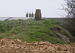
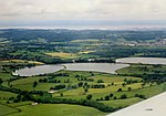
Dundry is a village and civil parish, situated on Dundry Hill in the northern part of the Mendip Hills, between Bristol and the Chew Valley Lake, in the English county of Somerset. The parish includes the hamlets of Maiden Head and East Dundry. The parish had a 2011 population of 829.The village lies on the route of the Monarch's Way long-distance footpath. It is a popular destination for the people of Bristol as it is known for its panoramic views of the city.

Excerpt from the Wikipedia article Dundry (License: CC BY-SA 3.0, Authors, Images).

Geographical coordinates (GPS)

Latitude Longitude
N 51.3957 ° E -2.6389 °
placeShow on map

Address

Crabtree Lane
BS41 8LN
England, United Kingdom
mapOpen on Google Maps

Dundry fairlawns
Dundry fairlawns
Share experience

Nearby Places

Littleton gunpowder works

Littleton gunpowder works between Winford and Chew Magna in the English county of Somerset, started gunpowder production around 1650 and continued until approximately 1820. It is a listed as a scheduled monument.The powder mill opened around 1740 following the expansion of the port in Bristol and increased availability of saltpetre from India. The mill was controlled by merchants based in the city and supplied gunpowder to ships sailing from the port. A previous warehouse, on the site where Bristol Temple Meads railway station now stands was considered too dangerous in the city. Despite a fire in 1755 the Littleton works expanded to become the largest gunpowder producing works in South West England by the middle of the 18th century. There was some association with another gunpowder mill at Woolley near Bath and the purchase and conversion of a snuff mill at nearby Stanton Drew was considered. It closed in the 1820s after the end of the Napoleonic Wars. It was powered by an overshot water wheel on Winford Brook a tributary of the River Chew.Some of the buildings remain intact, while others are ruined. The farmhouse was built in the mid 16th century but has been added to and revised in the 17th, 18th and 19th centuries. It is a Grade II* listed building, as is the 17th century barn. Powder Mill Cottage was built in the 18th century as the cooperage for the powder mill. The clock tower which was part of the works was originally attached to a chapel or office.

Barrow Gurney Reservoirs

Barrow Gurney Reservoirs (grid reference ST5468) (also known as Barrow Gurney Tanks or Barrow Tanks) are three artificial reservoirs for drinking water near the village of Barrow Gurney, which lies southwest of Bristol, England. They are known by their numbers rather than names. They are fed by several springs including one which becomes the Land Yeo. Some of the outfall is also used to feed the river which flows to the Bristol Channel. There are three reservoirs in total, one (Tank number three, 60 acres (24 ha) to the north of the A38 and two (Tank number one, 25 acres (10 ha) and number two, 40 acres (16 ha) to the south. The reservoirs are operated by Bristol Water. The first opened in 1852 to store the water from the newly finished "Line of Works", but within two years it developed a leak and had to be drained for repair, causing serious disruption to Bristol's water supply. Over the following decades, work was undertaken to improve the water quality. First with sand filters and in 1935 with chlorinationDuring 1962 maximum output was increased from 26 million imperial gallons (120,000 m3) to 31 million imperial gallons (140,000 m3) a day by lowering the outlet of the filtered tank and duplicating inlets to the seven filters which received microstrained water. The stony banks on all the tanks provide a habitat for sedges. Fishing (under permit) is generally for rainbow (Oncorhynchus mykiss, formerly Salmo iridia) and Brown trout (Salmo trutta morpha fario and S. trutta morpha lacustris).