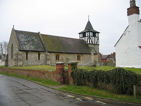
Defford
Earth stations in EnglandVillages in WorcestershireWorcestershire geography stubs

Defford is a small village in the county of Worcestershire, England, located between the towns of Pershore and Upton-upon-Severn. It was once part of the Royal forest of Horewell. The woodlands were mostly removed around the time of the Civil War.Defford also has a primary school, Defford cum Besford First School, and three pubs. Defford is home to one of the radio telescopes that make up the Jodrell Bank MERLIN (Multi-Element Radio Linked Interferometer Network) radio telescope array linking six observing stations that together form a powerful telescope with an effective aperture of over 217 kilometres.
Excerpt from the Wikipedia article Defford (License: CC BY-SA 3.0, Authors, Images).Defford
Harpley Road, Wychavon
Geographical coordinates (GPS) Address Nearby Places Show on map
Geographical coordinates (GPS)
| Latitude | Longitude |
|---|---|
| N 52.087346 ° | E -2.119104 ° |
Address
Harpley Road
Harpley Road
WR8 9BL Wychavon
England, United Kingdom
Open on Google Maps


