Stillingfleet

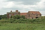
Stillingfleet is a village and civil parish in North Yorkshire, England. It was in the historic East Riding of Yorkshire, but since 1974 has come under North Yorkshire. It is about 6 miles (10 km) south of York and nearby settlements include Acaster Selby, Naburn and Appleton Roebuck. Stillingfleet was once the site of UK Coal's Stillingfleet Mine, part of the Selby Coalfield, which closed in 2004. St Helen's Church, the parish church, is a grade I listed building. Another notable building is Moreby Hall, which is grade II* listed.The village was historically in the East Riding of Yorkshire, but from 1974 to 2023 was in the Selby District of the shire county of North Yorkshire. In 2023 the district was abolished and North Yorkshire became a unitary authority.
Excerpt from the Wikipedia article Stillingfleet (License: CC BY-SA 3.0, Authors, Images).Stillingfleet
York Road,
Geographical coordinates (GPS) Address Nearby Places Show on map
Geographical coordinates (GPS)
| Latitude | Longitude |
|---|---|
| N 53.86188 ° | E -1.09921 ° |
Address
York Road
YO19 6SJ , Stillingfleet
England, United Kingdom
Open on Google Maps


