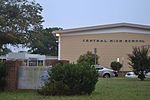
Seat Pleasant, Maryland
1850 establishments in MarylandCities in MarylandCities in Prince George's County, MarylandSuburbs of Washington, D.C.

Seat Pleasant is an incorporated city in Prince George's County, Maryland, United States, located immediately east of Washington. Per the 2020 census, the population was 4,522. Two state highways pass through the community — Maryland routes 704 (now called Martin Luther King Jr. Highway and previously named George Palmer Highway in honor of banker and community leader George Palmer) and 214 (Central Avenue). The Washington Metro's Blue and Silver Lines are nearby. The Washington Commanders' stadium is east of Seat Pleasant, near the Capital Beltway (I-95/495).
Excerpt from the Wikipedia article Seat Pleasant, Maryland (License: CC BY-SA 3.0, Authors, Images).Seat Pleasant, Maryland
70th Street,
Geographical coordinates (GPS) Address Nearby Places Show on map
Geographical coordinates (GPS)
| Latitude | Longitude |
|---|---|
| N 38.895277777778 ° | E -76.902222222222 ° |
Address
70th Street 421
20743
Maryland, United States
Open on Google Maps


