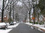
Mount Rainier, Maryland

Mount Rainier is a city in Prince George's County, Maryland, United States, bordering Washington D.C. The population was 8,333 at the 2020 census. Mount Rainier is contained between the Northwest Branch Anacostia River, Cedar Lane Alley, and 34th Street to the north, 37th Street and 37th Place to the northeast, Upshur Street and Queens Chapel Road to the west, the CSX Capital Subdivision train tracks to the east, and Eastern Avenue NE to the south. Mount Rainier got its start as a streetcar suburb, when tracks were laid for the 82 Streetcar Line. According to local tradition, surveyors from the Pacific Northwest named the town, giving the streets names such as Shasta and Cascade. Historic U.S. 1 runs through the center of the town and serves as the main street and central business district.
Excerpt from the Wikipedia article Mount Rainier, Maryland (License: CC BY-SA 3.0, Authors, Images).Mount Rainier, Maryland
Taylor Street,
Geographical coordinates (GPS) Address Nearby Places Show on map
Geographical coordinates (GPS)
| Latitude | Longitude |
|---|---|
| N 38.941666666667 ° | E -76.963611111111 ° |
Address
Taylor Street 3202
20712
Maryland, United States
Open on Google Maps


