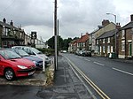
A1085 road
England road stubsInfobox road instances in EnglandInfobox road maps tracking categoryRoads in EnglandUse British English from February 2013

The A1085 is a road that runs from Middlesbrough to Marske-by-the-Sea in the former county of Cleveland. There is a long straight part of the road whilst it passes the former ICI Wilton plant towards Redcar, this part of the road is the main road towards Redcar from the west and towards Middlesbrough and the A66 from the east. It is 11.3 miles (18.2 km) long.
Excerpt from the Wikipedia article A1085 road (License: CC BY-SA 3.0, Authors, Images).A1085 road
Trunk Road,
Geographical coordinates (GPS) Address Nearby Places Show on map
Geographical coordinates (GPS)
| Latitude | Longitude |
|---|---|
| N 54.59279 ° | E -1.12692 ° |
Address
Trunk Road
Trunk Road
TS6 8JH
England, United Kingdom
Open on Google Maps


