Government of Amsterdam
The Government of Amsterdam consists of several territorial and functional forms of local and regional government. The principal form of government is the municipality of Amsterdam, Netherlands. The municipality's territory covers the city of Amsterdam as well as a number of small towns. The city of Amsterdam is also part of several functional forms of regional government. These include the Waterschap (water board) of Amstel, Gooi en Vecht, which is responsible for water management, and the Stadsregio (City Region) of Amsterdam, which has responsibilities in the areas of spatial planning and public transport. The municipality of Amsterdam borders the municipalities of Diemen, Abcoude, Ouder-Amstel and Amstelveen in the south, Haarlemmermeer and Haarlemmerliede en Spaarnwoude in the west, and Zaanstad, Oostzaan, Landsmeer and Waterland in the north.
Excerpt from the Wikipedia article Government of Amsterdam (License: CC BY-SA 3.0, Authors).Government of Amsterdam
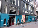
Sint Andrieshofje, Amsterdam Centrum
Geographical coordinates (GPS) Address Website Nearby Places Show on map
Geographical coordinates (GPS)
| Latitude | Longitude |
|---|---|
| N 52.366666666667 ° | E 4.8833333333333 ° |
Address
Grachtengordel van Amsterdam
Sint Andrieshofje
1016 EV Amsterdam, Centrum
North Holland, Netherlands
Open on Google Maps


