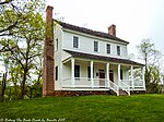
Bottom, North Carolina
Surry County, North Carolina geography stubsUnincorporated communities in North CarolinaUnincorporated communities in Surry County, North CarolinaUse mdy dates from July 2023
Bottom is an unincorporated community in the Stewarts Creek Township of northern Surry County, North Carolina, United States. The community is more commonly known as Beulah locally and is centered on the intersection of Beulah Road/Beulah Church Road and North Carolina Highway 89 (West Pine Street). The origin of the name "Bottom" is obscure.
Excerpt from the Wikipedia article Bottom, North Carolina (License: CC BY-SA 3.0, Authors).Bottom, North Carolina
Beulah Church Road,
Geographical coordinates (GPS) Address Nearby Places Show on map
Geographical coordinates (GPS)
| Latitude | Longitude |
|---|---|
| N 36.475 ° | E -80.774 ° |
Address
Beulah Church Road 108
27030
North Carolina, United States
Open on Google Maps

