Hampton Roads Bridge–Tunnel
Bridges completed in 1957Bridges of the United States Numbered Highway SystemBridges on the Interstate Highway SystemBridge–tunnels in North AmericaBuildings and structures in Hampton, Virginia ... and 19 more
Buildings and structures in Norfolk, VirginiaCross-sea traffic ways in North AmericaCrossings of the James River (Virginia)Former toll bridges in VirginiaFormer toll roads in VirginiaFormer toll tunnels in the United StatesImmersed tube tunnels in the United StatesInterstate 64Intracoastal WaterwayRoad bridges in VirginiaRoad tunnels in VirginiaTransportation in Hampton, VirginiaTransportation in Norfolk, VirginiaTrestle bridges in the United StatesTunnels completed in 1957Tunnels completed in 1976U.S. Route 60Use American English from May 2023Use mdy dates from May 2023

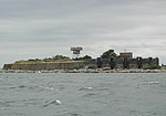
The Hampton Roads Bridge–Tunnel (HRBT) is a 3.5-mile-long (5.6 km) Hampton Roads crossing for Interstate 64 (I-64) and US Route 60 (US 60). It is a four-lane facility comprising bridges, trestles, artificial islands, and tunnels under the main shipping channels for Hampton Roads harbor in the southeastern portion of Virginia in the United States. It connects the historic Phoebus area of the independent city of Hampton near Fort Monroe on the Virginia Peninsula with Willoughby Spit in the city of Norfolk in South Hampton Roads and is part of the Hampton Roads Beltway.
Excerpt from the Wikipedia article Hampton Roads Bridge–Tunnel (License: CC BY-SA 3.0, Authors, Images).Hampton Roads Bridge–Tunnel
Hampton Roads Bridge-Tunnel, Hampton
Geographical coordinates (GPS) Address Nearby Places Show on map
Geographical coordinates (GPS)
| Latitude | Longitude |
|---|---|
| N 36.987197 ° | E -76.305542 ° |
Address
Hampton Roads Bridge-Tunnel
Hampton Roads Bridge-Tunnel
23651 Hampton
Virginia, United States
Open on Google Maps


