King's Caple
Herefordshire geography stubsVillages in Herefordshire

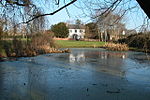
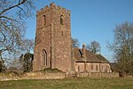
Kings Caple is a village in the largest loop of the River Wye between Hereford and Ross-on-Wye in the English county of Herefordshire. The population of the civil parish at the 2011 census was 331.
Excerpt from the Wikipedia article King's Caple (License: CC BY-SA 3.0, Authors, Images).King's Caple
Geographical coordinates (GPS) Address Nearby Places Show on map
Geographical coordinates (GPS)
| Latitude | Longitude |
|---|---|
| N 51.9569 ° | E -2.6393 ° |
Address
HR1 4TZ
England, United Kingdom
Open on Google Maps


