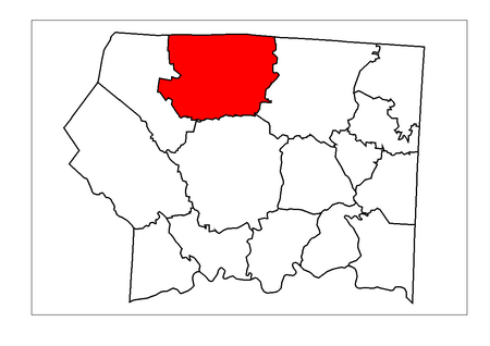
Stewarts Creek Township, Surry County, North Carolina
Surry County, North Carolina geography stubsTownships in North CarolinaTownships in Surry County, North CarolinaUse mdy dates from July 2023

Stewarts Creek Township is one of fifteen townships in Surry County, North Carolina, United States. The township had a population of 7,000 according to the 2020 census.Geographically, Stewarts Creek Township occupies 56.4 square miles (146 km2) in northern Surry County, with its northern border shared with the state of Virginia. There are no incorporated municipalities within Stewarts Creek Township; however, there are several smaller, unincorporated communities located here, including Bottom, Crooked Oak, Pine Ridge and Round Peak.
Excerpt from the Wikipedia article Stewarts Creek Township, Surry County, North Carolina (License: CC BY-SA 3.0, Authors, Images).Stewarts Creek Township, Surry County, North Carolina
Maple Grove Church Road,
Geographical coordinates (GPS) Address Nearby Places Show on map
Geographical coordinates (GPS)
| Latitude | Longitude |
|---|---|
| N 36.5297215 ° | E -80.7436141 ° |
Address
Maple Grove Church Road (State Road 1602)
Maple Grove Church Road
27024
North Carolina, United States
Open on Google Maps
