Glen Ogle
Glens of ScotlandStirling (council area) geography stubsValleys of Stirling (council area)

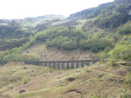
Glen Ogle (Scottish Gaelic: Gleann Ogail) extends 7 miles north westwards from Lochearnhead to Lix Toll, where it opens into Glen Dochart. The Ogle Burn flows within the steep sides of the glen, from the Lochan Lairig Cheile at the glen's head. The military road, which can be seen from the modern road, was built in 1749 by Major William Caulfeild. It was used by the British Army in its efforts to pacify the Highlands after the Jacobite rising of 1745.
Excerpt from the Wikipedia article Glen Ogle (License: CC BY-SA 3.0, Authors, Images).Glen Ogle
A85,
Geographical coordinates (GPS) Address Nearby Places Show on map
Geographical coordinates (GPS)
| Latitude | Longitude |
|---|---|
| N 56.408333333333 ° | E -4.3125 ° |
Address
A85
FK19 8QB
Scotland, United Kingdom
Open on Google Maps


