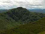
Breadalbane, Scotland

Breadalbane , from Scottish Gaelic Bràghaid Albann ("upper Alba" or "upland of Alba"), is a region of the southern/central Scottish Highlands. It is a mountainous region comprising the watershed of Loch Tay; its boundaries are roughly the West Highland Way in the west, Rannoch Moor in the northwest, Loch Rannoch in the north, the River Tummel in the east, the Highland boundary in the southeast, and Loch Earn and Loch Voil-Loch Doine in the south. The former Breadalbane district was surrounded by the districts of Atholl, Strathearn, Menteith, The Lennox, Argyll and Lochaber. The Breadalbane Hydro-Electric Scheme lies within the region. The Atholl and Breadalbane Gathering is a popular 2/4 March tune for the Great Highland Bagpipes.
Excerpt from the Wikipedia article Breadalbane, Scotland (License: CC BY-SA 3.0, Authors, Images).Breadalbane, Scotland
Geographical coordinates (GPS) Address Nearby Places Show on map
Geographical coordinates (GPS)
| Latitude | Longitude |
|---|---|
| N 56.34 ° | E -4.274 ° |
Address
Stirling
Scotland, United Kingdom
Open on Google Maps


