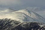
Strathyre
Stirling (council area) geography stubsVillages in Stirling (council area)

Strathyre (; from Scottish Gaelic: Srath Eadhair) is a district and settlement in the Stirling local government district of Scotland. It forms the south-eastern part of the parish of Balquhidder and was, prior to the 1973 reorganisation of local government, part of Perthshire. It is within the bounds of the Loch Lomond and the Trossachs National Park. In Gaelic, the district is Srath Eadhair and the village is An t-Iomaire Riabhach or an t-Iomaire Fada.
Excerpt from the Wikipedia article Strathyre (License: CC BY-SA 3.0, Authors, Images).Strathyre
A84,
Geographical coordinates (GPS) Address Nearby Places Show on map
Geographical coordinates (GPS)
| Latitude | Longitude |
|---|---|
| N 56.324 ° | E -4.329 ° |
Address
A84
FK18 8NA
Scotland, United Kingdom
Open on Google Maps


