Flevopolder
All pages needing cleanupArtificial islands of the NetherlandsPolders of FlevolandRegions of FlevolandRegions of the Netherlands

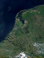
The Flevopolder is an island polder forming the bulk of Flevoland, a province of the Netherlands. Created by land reclamation, its northeastern part was drained in 1955 and the remainder—the southwest—in 1968. Unlike other major polders, it is surrounded by lakes and below-sea-level channels. By some definitions, it is the world's largest artificial island. Levees, dikes, and pumping were used to drain the land. The polder's name references the ancient Lake Flevo. The Flevopolder, along with the Noordoostpolder, forms the Flevoland province, which is located near Amsterdam in the southwest and Kampen, Overijssel in the northeast.
Excerpt from the Wikipedia article Flevopolder (License: CC BY-SA 3.0, Authors, Images).Flevopolder
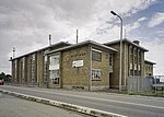
Tjalk 31, Lelystad
Geographical coordinates (GPS) Address Nearby Places Show on map
Geographical coordinates (GPS)
| Latitude | Longitude |
|---|---|
| N 52.5 ° | E 5.4666666666667 ° |
Address
Tjalk 31 5
8232 ND Lelystad
Flevoland, Netherlands
Open on Google Maps


