place

Lake Flevo

Former lakes of the NetherlandsHistory of FlevolandLakes of the NetherlandsLandforms of Flevoland
500vc ex leg copy
500vc ex leg copy

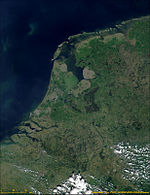
Lake Flevo was a lake in what is now the Netherlands, which existed in Roman times and the early Middle Ages. Some geographers believe that it was not a single lake, but rather a set of interconnected lakes. From the Indo-European root *plew- "flow", the name was transmitted by the Roman geographer Pomponius Mela in describing this region. In his treatise on geography of 44 AD, Pomponius speaks of a Flevo Lacus. He writes: "The northern branch of the Rhine widens as Lake Flevo, and encloses an island of the same name, and then as a normal river flows to the sea". Other sources rather speak of Flevum, which could be related to today's Vlie (Vliestroom), i.e. the seaway between the Dutch islands of Vlieland and Terschelling. This last name is grammatically more probable for a geographical indication, which is why it is assumed that Pomponius confused the declension of the word giving the name Flevo. In fact the Vlie formed outfall from the lake into the North Sea. Some texts of the middle-ages refer to this lake by the name of Almere. December 14, 1287, in what was called St. Lucia's flood during a memorable storm in Friesland and Holland, the North Sea invaded the freshwater lake, breaking and destroying several dams dunes and transformed it into a bay which was then called the Zuiderzee, meaning Southern Sea. In the second half of the twentieth century the Flevopolders and a new province, Flevoland, took the name of the body of water which lay there long ago.

Excerpt from the Wikipedia article Lake Flevo (License: CC BY-SA 3.0, Authors, Images).

Geographical coordinates (GPS)

Latitude Longitude
N 52.48 ° E 5.4 °
placeShow on map

Address

Lelystad


Lelystad
Flevoland, Netherlands
mapOpen on Google Maps

500vc ex leg copy
500vc ex leg copy
Share experience

Nearby Places

Mediumwave transmitter Flevoland

The mediumwave transmitter Flevoland (Middengolf Zendstation Flevoland) was a broadcasting facility for medium wave near Zeewolde in the province of Flevoland, Netherlands, situated at 5°25′ E and 52°23′ N. It has been used for broadcasting on 747 kHz (until September 2015) and 1008 kHz with a nominal power of 400 kilowatts. As aerial two guyed steel framework masts with a height of 195 metres are used, which form an anti-fading aerial. These masts are grounded and carry a cage aerial, which is upperward the separation insulator, separating the masts in a height of 95 metres in two parts, connected toward the mast construction. The radiation diagram is directional, with a maximum gain of 4 dB in South-Eastern direction, to compensate for the variation in electrical admittance of terrain in the Netherlands. The station, which came into service in 1980, initially carried the programmes of Hilversum 1 and Hilversum 2. In 1985, following an overhaul of the Dutch public radio service, the frequencies were reassigned to NPO Radio 1 and NPO Radio 5 for 747 kHz and 1008 kHz respectively. In 2003, the 1008 kHz frequency was auctioned by the Dutch Government while NPO Radio 5 remained on 747 kHz. Since then, the 1008 kHz has been used by Radio 10 Gold (from 2004 to 2007) and Groot Nieuws Radio, a Dutch privately owned religious station.In September 2014, NPO announced that distribution of NPO Radio 5 on Medium wave would be discontinued as of September 2015. On 1 September 2015 at 00:02 CEST, the 747 kHz transmitter closed down, marking the end of Medium wave transmissions by the Dutch Public Broadcasters. The 1008 kHz remained in use by Groot Nieuws Radio, though at reduced power of 100 kW. Groot Nieuws Radio ceased broadcasting at 31 December 2018. On 9 January 2019 the masts were demolished with explosives, marking the definitive end of mediumwave broadcasting from this location. This was the last large mediumwave transmitter in The Netherlands, marking the end of a 90-year era of mediumwave broadcasting.