Clock Face, St Helens
Merseyside geography stubsSt Helens, MerseysideTowns and villages in the Metropolitan Borough of St Helens

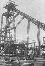
Clock Face is a village and area of St Helens, England, 5.6 km (3.5 mi) south of the town centre. It is a ward within the Metropolitan Borough of St Helens and forms part of the parish of Bold. Historically a part of Lancashire, the village and area is so named because of a large clock face that adorned the Inn. The name was also adopted by a colliery in the area. The Clock Face public house, although not the original building, is built close to the original location and maintains the naming tradition.
Excerpt from the Wikipedia article Clock Face, St Helens (License: CC BY-SA 3.0, Authors, Images).Clock Face, St Helens
Clock Face Road,
Geographical coordinates (GPS) Address Nearby Places Show on map
Geographical coordinates (GPS)
| Latitude | Longitude |
|---|---|
| N 53.41554 ° | E -2.7098 ° |
Address
Clock Face Road
Clock Face Road
WA9 4QS , Union Bank
England, United Kingdom
Open on Google Maps


