place

Point Defiance Park

1888 establishments in Washington TerritoryJapanese gardens in the United StatesNorth Tacoma, WashingtonParks in Pierce County, WashingtonPoint Defiance
Protected areas established in 1888Regional parks in the United StatesTourist attractions in Tacoma, Washington
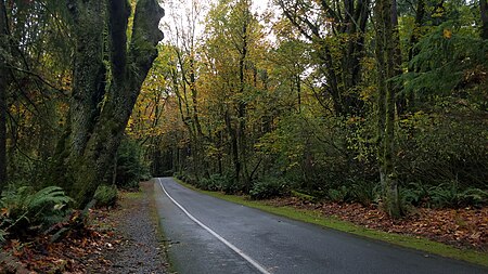
Point Defiance Forest

Point Defiance Park in Tacoma, Washington, United States, is a large urban park. The 760-acre (3.1 km2) park includes Point Defiance Zoo & Aquarium, the Rose Garden, Rhododendron Garden, beaches, trails, a boardwalk, a boathouse, a Washington State Ferries ferry dock for the Point Defiance-Tahlequah route to Vashon Island, Fort Nisqually, an off-leash dog park, and most notably about 400 acres of old-growth forest. It receives more than three million visitors every year. Point Defiance Park is maintained and operated by Metro Parks Tacoma.

Excerpt from the Wikipedia article Point Defiance Park (License: CC BY-SA 3.0, Authors, Images).

Point Defiance Park
Five Mile Road, Tacoma

Geographical coordinates (GPS) Address Nearby Places
placeShow on map

Wikipedia: Point Defiance ParkContinue reading on Wikipedia

Geographical coordinates (GPS)

Latitude Longitude
N 47.31 ° E -122.53 °
placeShow on map

Address

Five Mile Road

Five Mile Road
98407 Tacoma
Washington, United States
mapOpen on Google Maps

Point Defiance Forest
Share experience

Nearby Places

Tacoma Narrows Bridge (1950)

The 1950 Tacoma Narrows Bridge is a suspension bridge in the U.S. state of Washington that carries the westbound lanes of Washington State Route 16 (known as Primary State Highway 14 until 1964) across the Tacoma Narrows strait, between the city of Tacoma and the Kitsap Peninsula. Opened on October 14, 1950, it was built in the same location as the original Tacoma Narrows Bridge, which collapsed due to a windstorm on November 7, 1940. It is the older of the twin bridges that make up the Tacoma Narrows Bridge crossing of the Tacoma Narrows, and carried both directions of traffic across the strait until 2007. At the time of its construction, the bridge was, like its predecessor, the third-longest suspension bridge in the world in terms of main span length, behind the Golden Gate Bridge and George Washington Bridge; it is now the 46th longest suspension bridge in the world. Design work on a new Tacoma Narrows Bridge began shortly after the collapse of the original bridge. However, several engineering issues, the demand on steel created by the United States' involvement in World War II, and the state of Washington's inability to find an insurer, all pushed the start of construction to April 1948. The new bridge was designed with a wider deck and taller and wider towers than its predecessor, and addressed the wind issues that led to the original bridge's collapse. It opened to the public on October 14, 1950, and carried both directions of Primary State Highway 14 for over 40 years. Tolls were charged on the bridge until 1965, when the bonds were retired 13 years ahead of schedule. “The price tag for construction was one-third more than the Toll Bridge Authority estimated--$11.2 million. The final construction cost estimate, made just prior to the bond issue, reached $13,738,000.”By 1990, population growth and development on the Kitsap Peninsula caused vehicular traffic on the bridge to exceed its design capacity. In 1998, voters in several Washington counties approved an advisory measure to create a twin bridge to span the Tacoma Narrows. After a series of protests and court battles, construction began on the second span in 2002. The second span opened in July 2007 to carry eastbound traffic, and the 1950 bridge was reconfigured to carry westbound traffic.

Tacoma Narrows Bridge

The Tacoma Narrows Bridge is a pair of twin suspension bridges that span the Tacoma Narrows strait of Puget Sound in Pierce County, Washington. The bridges connect the city of Tacoma with the Kitsap Peninsula and carry State Route 16 (known as Primary State Highway 14 until 1964) over the strait. Historically, the name "Tacoma Narrows Bridge" has applied to the original bridge nicknamed "Galloping Gertie", which opened in July 1940, but collapsed possibly because of aeroelastic flutter four months later, as well as the replacement of the original bridge which opened in 1950 and still stands today as the westbound lanes of the present-day two-bridge complex. The original Tacoma Narrows Bridge opened on July 1, 1940. The original bridge received its nickname "Galloping Gertie" due to of the vertical movement of the deck observed by construction workers during windy conditions. While engineers and engineering professor, F. B. Farquharson were hired to seek ways to stop the odd movements, months of experiments were unsuccessful. The bridge became known for its pitching deck, and collapsed into Puget Sound the morning of November 7, 1940, under high wind conditions. Engineering issues, as well as the United States' involvement in World War II, postponed plans to replace the bridge for several years; the replacement bridge was opened on October 14, 1950. By 1990, population growth and development on the Kitsap Peninsula had caused traffic on the bridge to exceed its design capacity; as a result, in 1998 Washington voters approved a measure to support building a parallel bridge. After a series of protests and court battles, construction began in 2002 and the new bridge opened to carry eastbound traffic on July 16, 2007, while the 1950 bridge was reconfigured to carry westbound traffic.At the time of their construction, both the 1940 and 1950 bridges were the third-longest suspension bridges in the world in terms of main span length, behind the Golden Gate Bridge and George Washington Bridge. The 1950 and 2007 bridges are as of 2017 the fifth-longest suspension bridge spans in the United States and the 43rd-longest in the world. Tolls were charged on the bridge for the entire four-month service life of the original span, as well as the first 15 years of the 1950 bridge. In 1965, the bridge's construction bonds plus interest were paid off, and the state ceased toll collection on the bridge. Over 40 years later, tolls were reinstated as part of the financing of the twin span, and are presently collected only from vehicles traveling eastbound.