Ra'na
Arab villages depopulated during the 1948 Arab–Israeli WarDistrict of HebronPages with non-numeric formatnum arguments

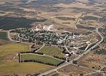
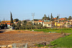
Ra'na (Arabic: رعنة) was a village located approximately 26 km northwest of Hebron. It was occupied by the Israeli army during Operation Yo'av in October 1948. It was one of 16 villages in the Hebron district that were depopulated.
Excerpt from the Wikipedia article Ra'na (License: CC BY-SA 3.0, Authors, Images).Ra'na
353, Yoav Regional Council
Geographical coordinates (GPS) Address Nearby Places Show on map
Geographical coordinates (GPS)
| Latitude | Longitude |
|---|---|
| N 31.665833333333 ° | E 34.878611111111 ° |
Address
353
8202280 Yoav Regional Council
South District, Israel
Open on Google Maps


