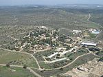
Tell ej-Judeideh

Tell ej-Judeideh (Arabic: تل الجديدة / خربة الجديدة) is a tell in modern Israel, lying at an elevation of 398 metres (1,306 ft) above sea-level. The Arabic name is thought to mean, "Mound of the dykes." In Modern Hebrew, the ruin is known by the name Tell Goded (תל גודד). The tell, about 2 kilometres (1.2 mi) north of Beit Guvrin and 9.7 kilometres southeast of Tell es-Safi, was first surveyed by Frederick Jones Bliss in June 1897, and partially excavated by Bliss and R.A.S. Macalister in March 1900. It has tentatively been identified with the biblical Moresheth-Gath, while others think that it might be Ashan of Joshua 15:42, based on the name's proximity to Libnah (thought by Albright to possibly be Tel Burna) and to Ether, a site now recognized as Khirbet el-Ater (grid position 138/113 PAL).Members of the Palestine Exploration Fund visited the site in the late 19th-century and described seeing there "foundations, heaps of stones, and a cistern."
Excerpt from the Wikipedia article Tell ej-Judeideh (License: CC BY-SA 3.0, Authors, Images).Tell ej-Judeideh
38, Mate Yehuda Regional Council
Geographical coordinates (GPS) Address Nearby Places Show on map
Geographical coordinates (GPS)
| Latitude | Longitude |
|---|---|
| N 31.633333333333 ° | E 34.916666666667 ° |
Address
38
9920828 Mate Yehuda Regional Council
Jerusalem District, Israel
Open on Google Maps


